
Immediately adjacent to M1 Junction 30.
Site Description & Context
The site is located immediately adjacent to M1 Junction 30, on the strategic route between Chesterfield and Renishaw, close to the A6135 Chesterfield Road and A619 Worksop Road. The surrounding environment is dominated by motorway infrastructure, junction slip roads, roundabouts and established roadside commercial uses within Barlborough.
An existing vehicular access is already present, currently serving agricultural use. The access is of generous width and benefits from visibility splays in excess of approximately 170 metres. It is positioned immediately downstream of the main junction where traffic movements are controlled, and a pass-over/crossover facility exists enabling vehicles to return in the opposite direction without needing to circulate the full junction arrangement.
The existing access road surface is currently of poor standard — tarmac/farm track condition — down to the agricultural buildings and would require upgrading to an adoptable or suitable commercial standard, including surfacing, radii, drainage and construction thickness, to accommodate intensified use including service vehicles and potential HGV movements. Directly opposite is an established gated commercial access serving industrial and warehousing uses, reinforcing the established commercial character of this junction location.
Given the strategic nature of the junction and anticipated intensity of use, the report considers it highly likely that the development would be required to contribute to, or deliver, highway improvement works at this intersection, potentially including construction of a roundabout or other appropriate junction mitigation, subject to detailed highways assessment and agreement with the Highway Authority.
Planning Designations
- Green Belt — Bolsover District Local Plan, Policy SS10.
- ITCR9 — Local Transport Improvement Scheme, M1 Junction 30.
- Former HS2 safeguarding and route alignment shown on the adopted Local Plan (2020).
- Site not designated as a Local Wildlife Site.
- Adjacent hedgerow designated Strategic Green Infrastructure — wildlife corridor / stepping stones.
- Site lies outside Flood Zone 3.
Land Ownership & Title
The site forms part of land registered under Title Number DY463998 and is subject to a Transfer of Part dated 10 June 2011. The transfer document includes standard rights and reservations relating to access, services, drainage and utilities, which are typical for land of this nature and do not place any restriction on development in planning terms.
The transfer also includes a Development Value Clawback (Overage) Covenant, applicable for a period of 25 years from the date of transfer, expiring June 2036. The covenant provides for payment of 50% of any uplift in value attributable to non-agricultural development, including commercial or infrastructure-led development, triggered by the grant, implementation or disposal of a planning permission.
This covenant represents a commercial and legal consideration rather than a planning constraint. It does not preclude development and would be addressed through landowner agreement and viability appraisal as the project progresses.
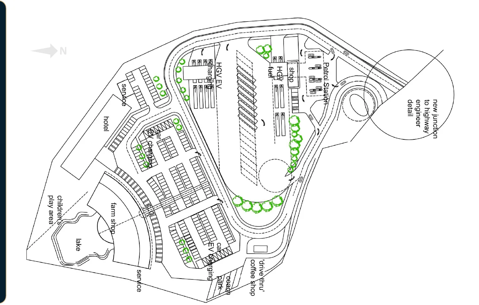 Latest site layout